Deforestation Index
Are your operations or supply chains driving deforestation?
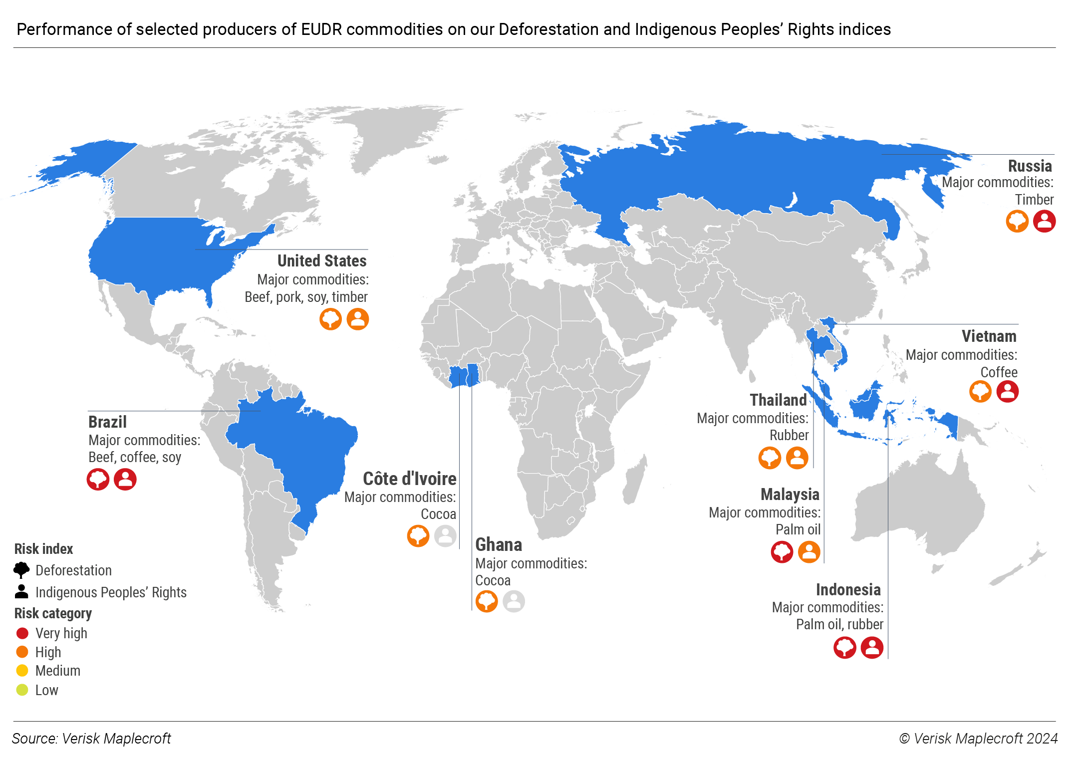
Our Deforestation Index combines satellite data of net forest loss with a spatial resolution of 430m² with a qualitative assessment of how well forests are protected to pinpoint areas where deforestation risks are greatest.
The Deforestation Index can help you
Screen
Screen and compare operations and supply chains for forest loss risks
Understand
Understand the areas that pose most threat to achieving internal targets and international benchmarks
Align
Align corporate strategy with global standards like the Sustainable Development Goals (SDGs)
Who could benefit from the index?
Investor relations
Monitor and share deforestation risk data on a topic of growing interest to investors, regulators and customers
Procurement & Supply Chain
Understand where deforestation poses a risk to sustainability benchmarks
Portfolio Managers
Assess quantitative deforestation data, a key ESG metric
Features and benefits at-a-glance
191
Comparable scores across sites for 191 countries
430m²
Global subnational map with a spatial resolution of 430m²
2014
Consistent dataset since 2014
Report

Download a sample report
Download a sample report from our Deforestation Index: Gold mining drives Amazon deforestation in Suriname
DownloadRelated content
Real Asset ESG, climate & nature risk solutions
Incorporate granular ESG, climate and nature risk data into real estate, infrastructure, agriculture and natural resources investment strategies
Environmental Risk Dataset
Geospatial insights into nature-related risks to resilience and sustainability
Climate & environment
Building corporate and investor resilience to climate and environmental risks

Download a sample report from our Deforestation Index
Please complete the form to download the report.